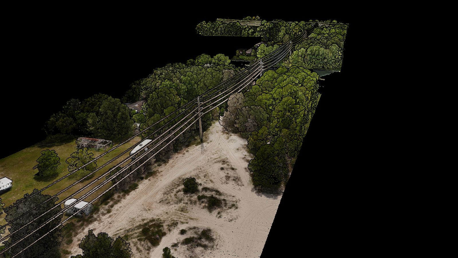
KPM Franklin recently performed a right of way aerial survey along several miles of an electric utility transmission line corridor in Florida to identify areas where encroaching vegetation could potentially cause an outage.
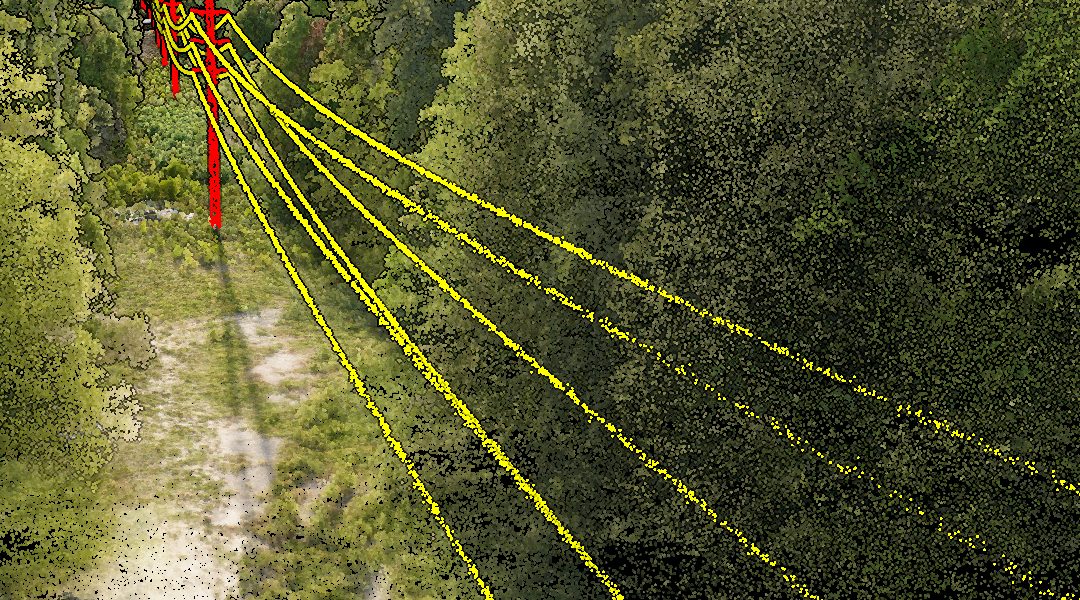
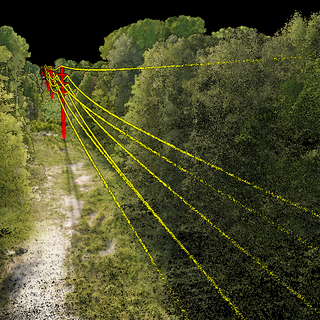
For about half the price of a helicopter flight, we mapped transmission lines, insulators, poles and other structural assets within centimeters of their exact location using our Harris-Aerial Carrier H6 Hybrid Drone equipped with a RIEGL Minivux 3UAV LiDAR system.
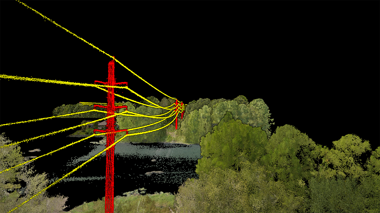
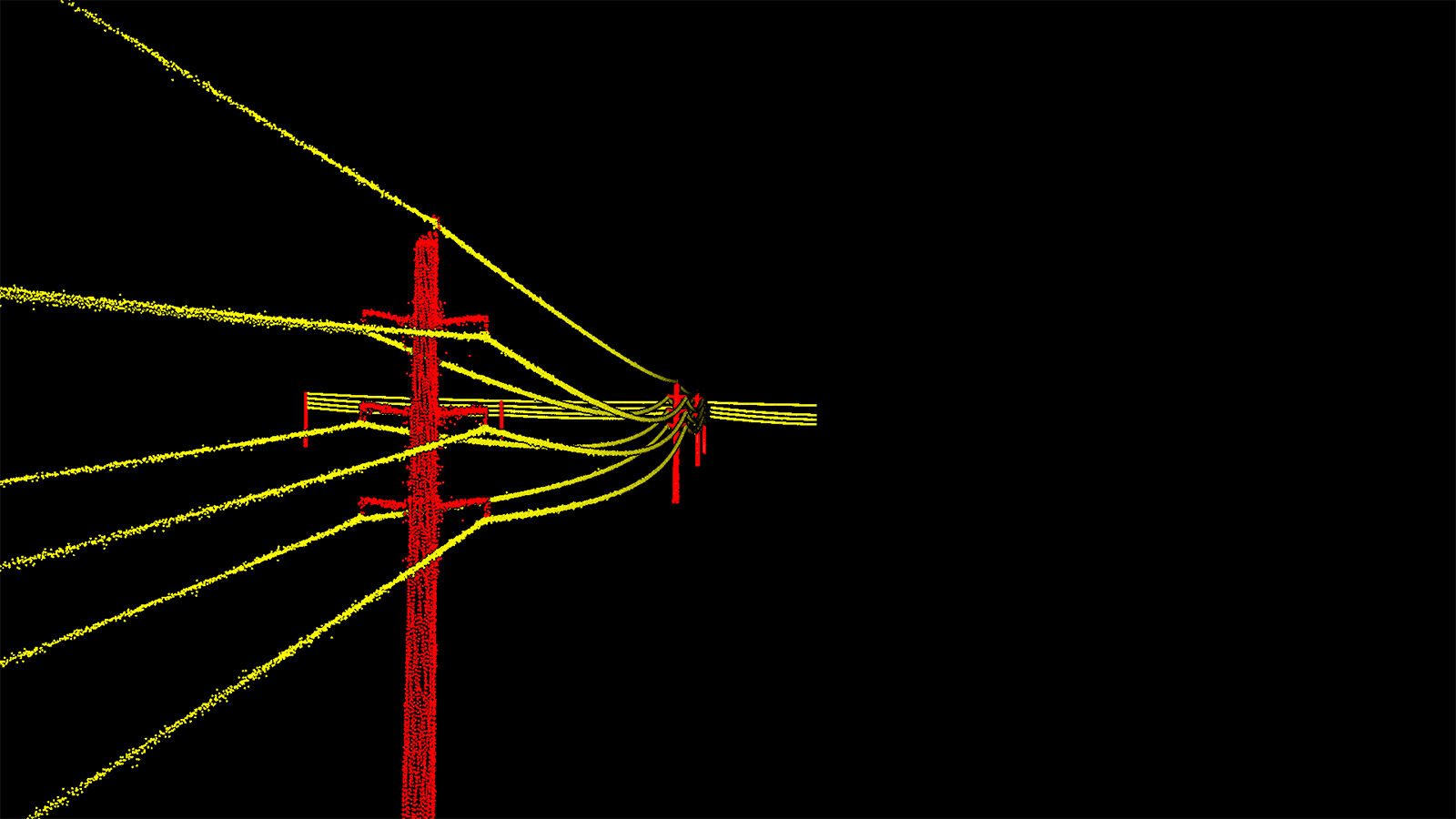
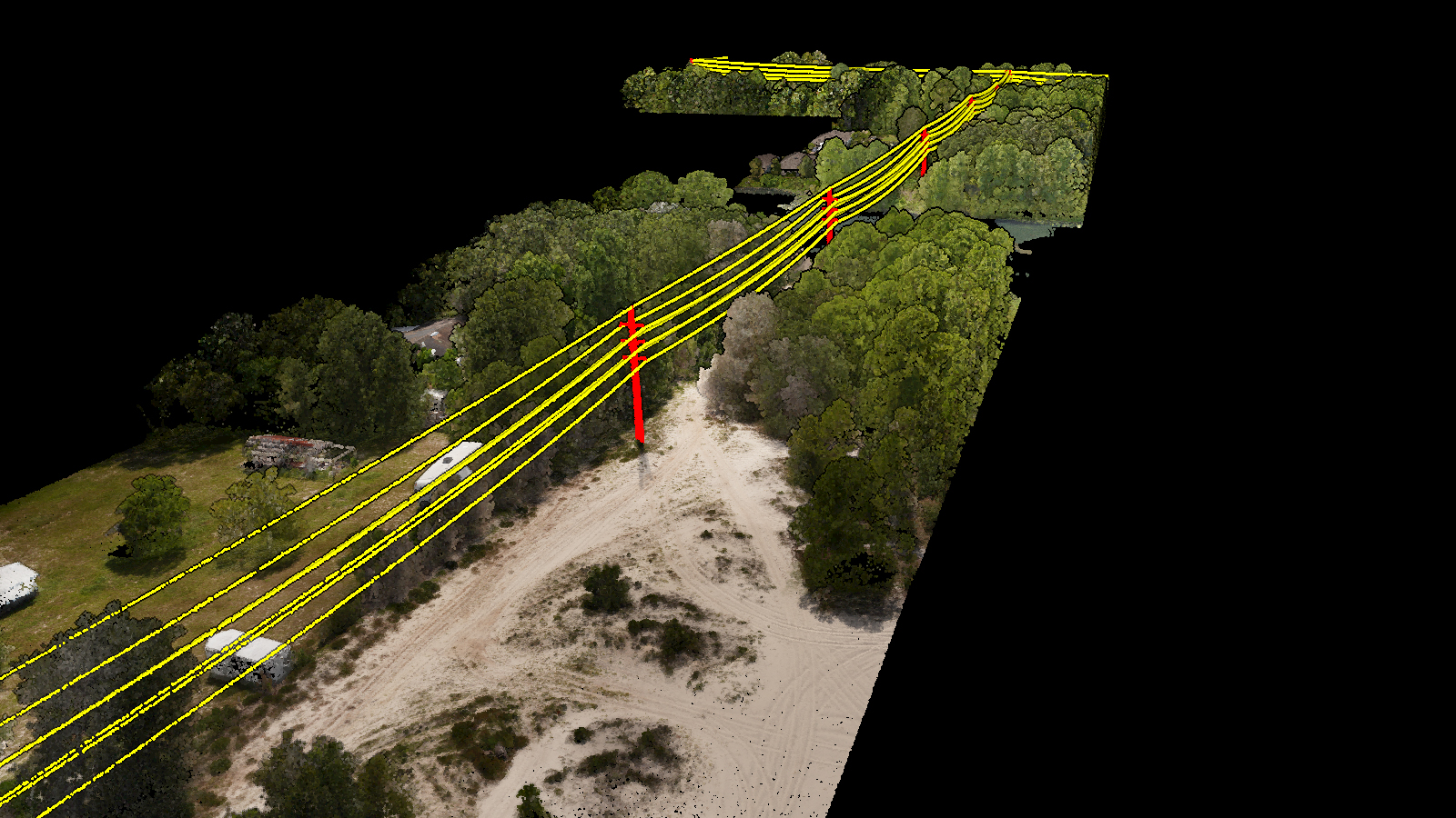
We also used the LiDAR data to create a 3D model and output ultra high-resolution images for calculating pole height and lean, determining the exact distance between transmission lines and vegetation and identifying locations where older transmission lines are beginning to sag and need maintenance.
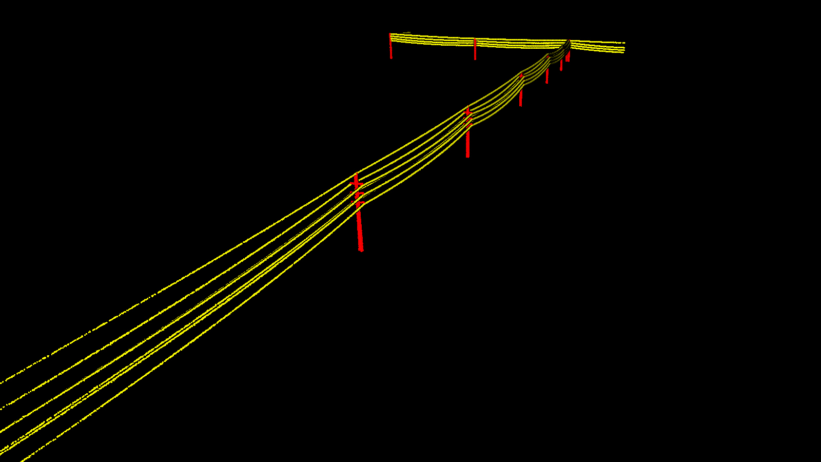
Utility companies can import our LiDAR survey data files into PLS-CADD for creating 3D models of the terrain and their transmission line and structural assets for drafting, materials cost estimating and other purposes.
For about half the price of a helicopter flight, we mapped transmission lines, insulators, poles and other structural assets within centimeters of their exact location using our Harris-Aerial Carrier H6 Hybrid Drone equipped with a RIEGL Minivux 3UAV LiDAR system.
We also used the LiDAR data to create a 3D model and output ultra high-resolution images for calculating pole height and lean, determining the exact distance between transmission lines and vegetation and identifying locations where older transmission lines are beginning to sag and need maintenance.
Utility companies can import our LiDAR survey data files into PLS-CADD for creating 3D models of the terrain and their transmission line and structural assets for drafting, materials cost estimating and other purposes.