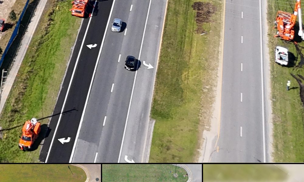
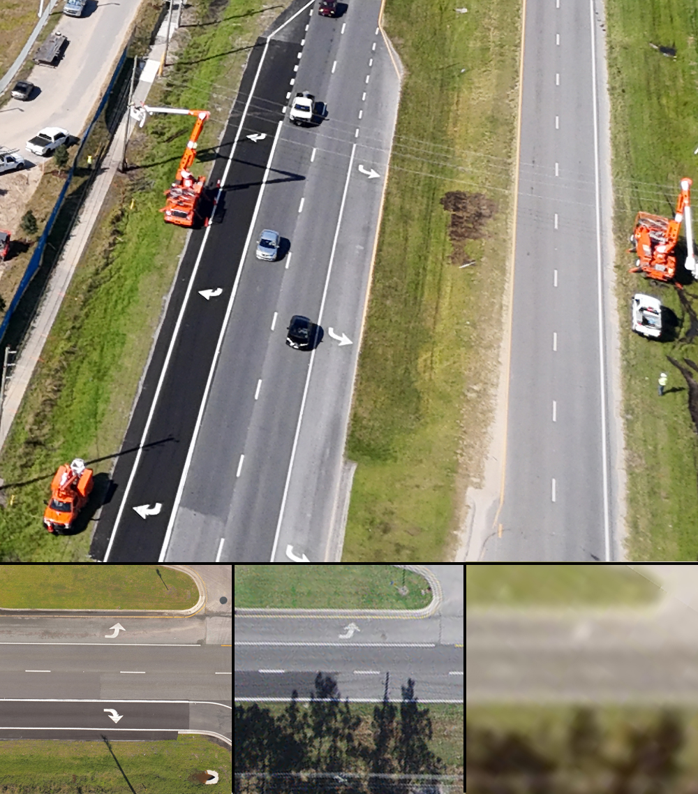
Aerial images from a recent right of way aerial survey we performed on a right turn lane on South Poinciana Blvd. in Kissimmee, Fla. demonstrate how our LiDAR aerial surveying system can produce highly accurate high-resolution orthomosaics for multiple uses. The turn lane is from a project designed by our engineers.
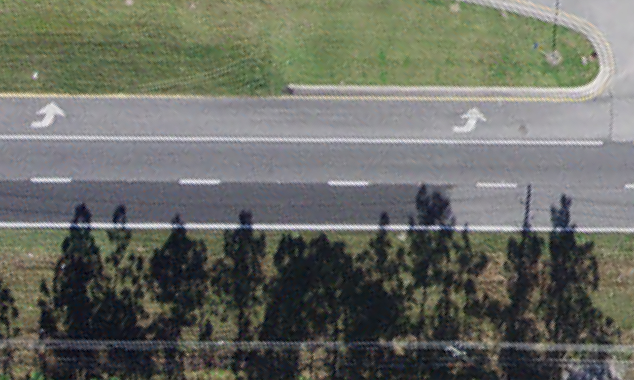
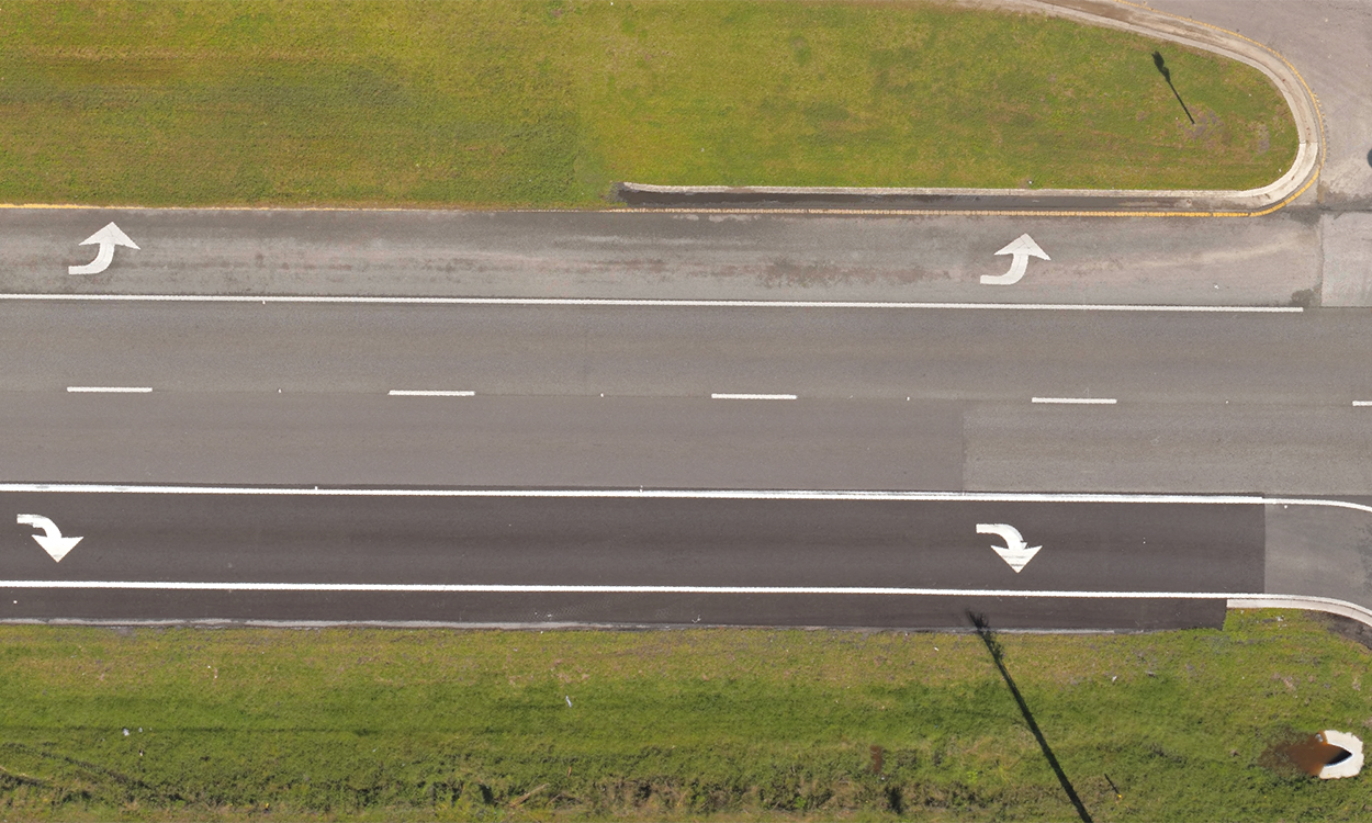
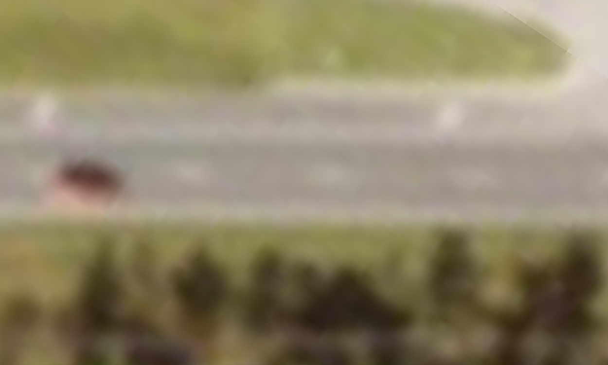
At the bottom of the first image, the left image is an orthomosaic taken at 225 feet by our Harris-Aerial Carrier H6 Hybrid Drone equipped with a RIEGL Minivux 3UAV LiDAR system, the middle image was taken at 2,000 feet from an airplane and the right image was taken at 280 miles by a satellite.
The orthomosaic provides 10 times better resolution than the airplane image and 40 times better resolution than the satellite image.
The orthomosaic also is geolocated which makes it accurate enough for use in CAD software by our civil engineers, landscape architects, planners and surveyors.
We also provide orthomosaics to our clients so they can take accurate measurements to determine where they want structures and other surface features to be located at project sites.