
2024 Completed Projects
KPM Franklin is proud to showcase nine innovative projects completed this year where our firm provided civil engineering design, landscape architecture design, land surveying, unmanned
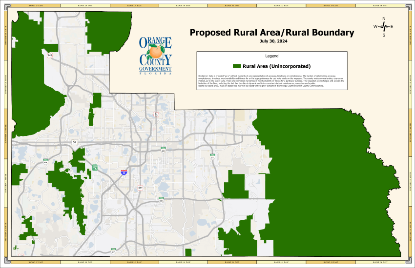
Orange County Charter Amendments Propose Changes to Rural Boundaries and Annexations
Orange County has proposed charter amendments 9 and 10, which will be present on the election ballot on November 5. If passed, the amendments will

Osceola County Approves Significant Increases to Impact Fees
On September 9, the Osceola County Board of County Commissioners voted to increase one-time mobility impact fees for single family residential developments by more than
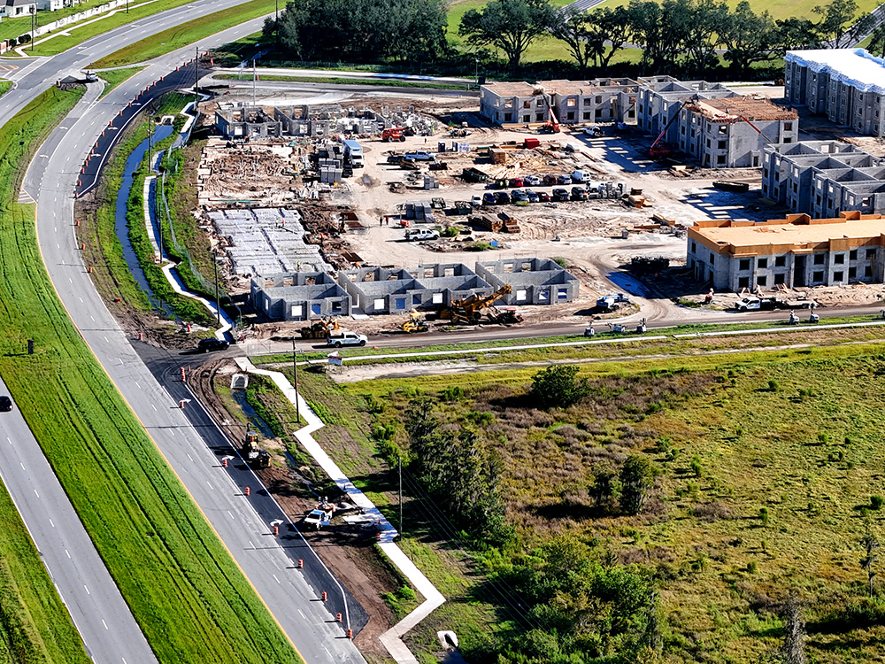
Falcon Trace II Right Turn Lane
The Offsite improvements at the Falcon Trace II multi-family residential project in Kissimmee Fla. are complete with the addition of two left turn lanes on
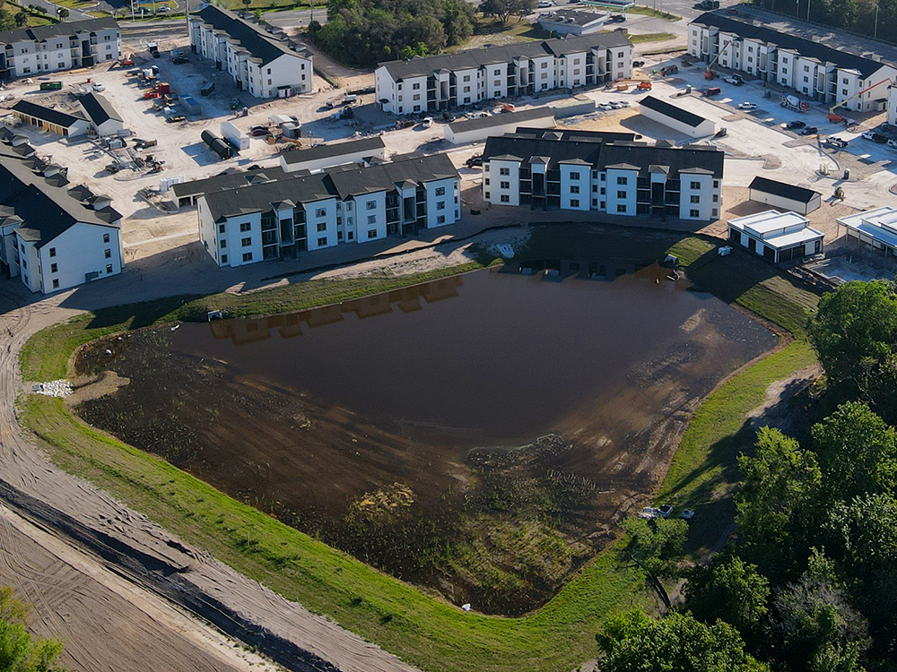
Aquatic Vegetation Filters Stormwater Runoff
Aquatic vegetation is beginning to sprout in a redesigned and expanded stormwater retention pond at the Hillpointe Pointe Grand Davenport multi-family residential project in Polk
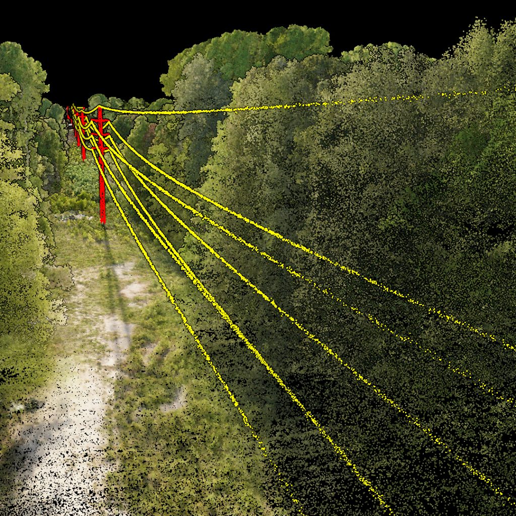
Aerial LiDAR Mapping Transmission Line Corridor
KPM Franklin recently performed a right of way aerial survey along several miles of an electric utility transmission line corridor in Florida to identify areas