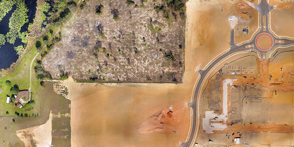
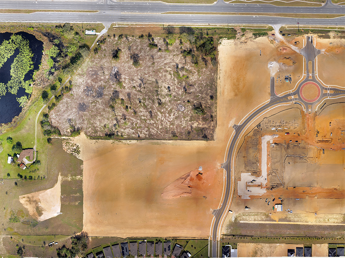
KPM Franklin’s Unmanned Aerial Surveying (UAS) Services can produce 3D surface maps – DEM, DTM and DSM – that are easier to analyze visually with CAD or GIS software. These datasets have a smaller size than a point cloud model which allows for more practical sharing and storing of data collected from our aerial LiDAR systems.
To learn more about our Unmanned Aerial Surveying services, visit services.kpmfranklin.com/uas
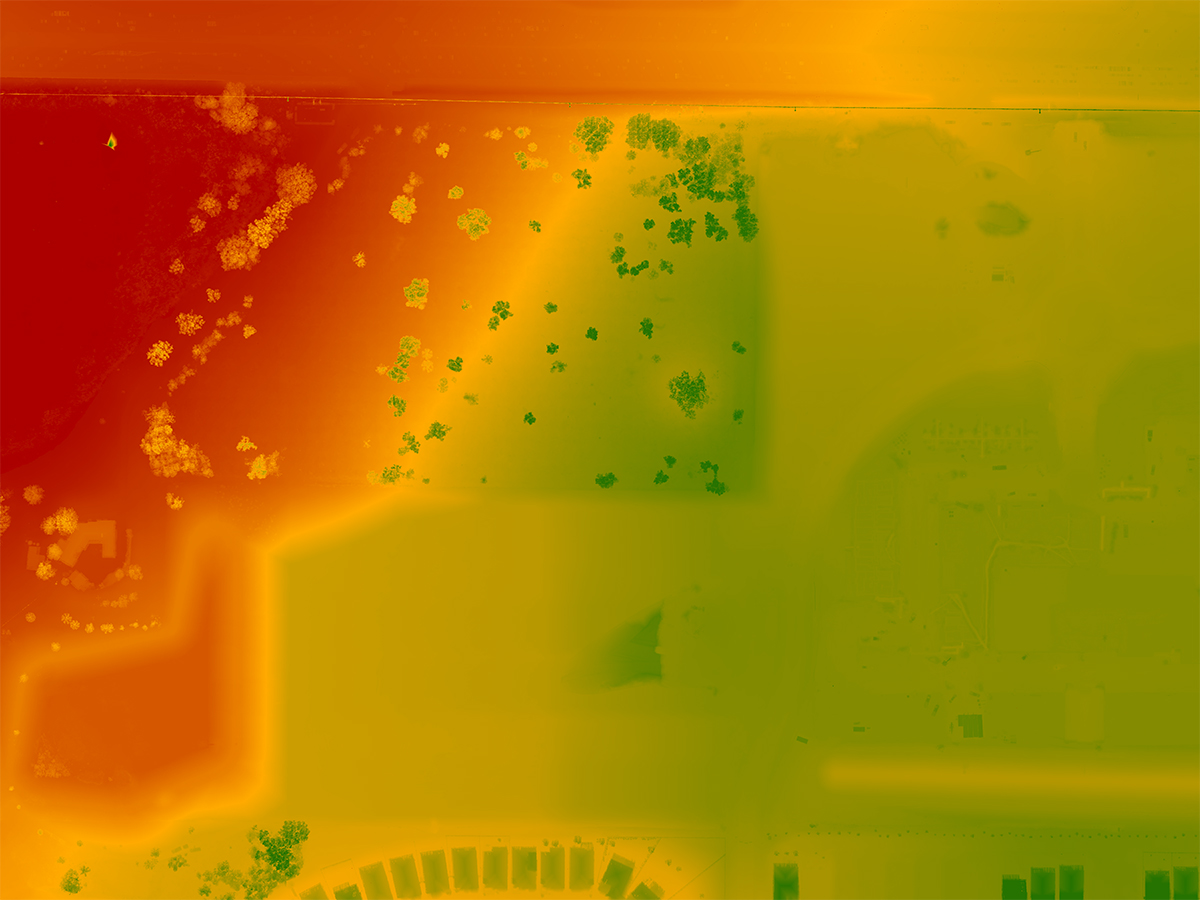
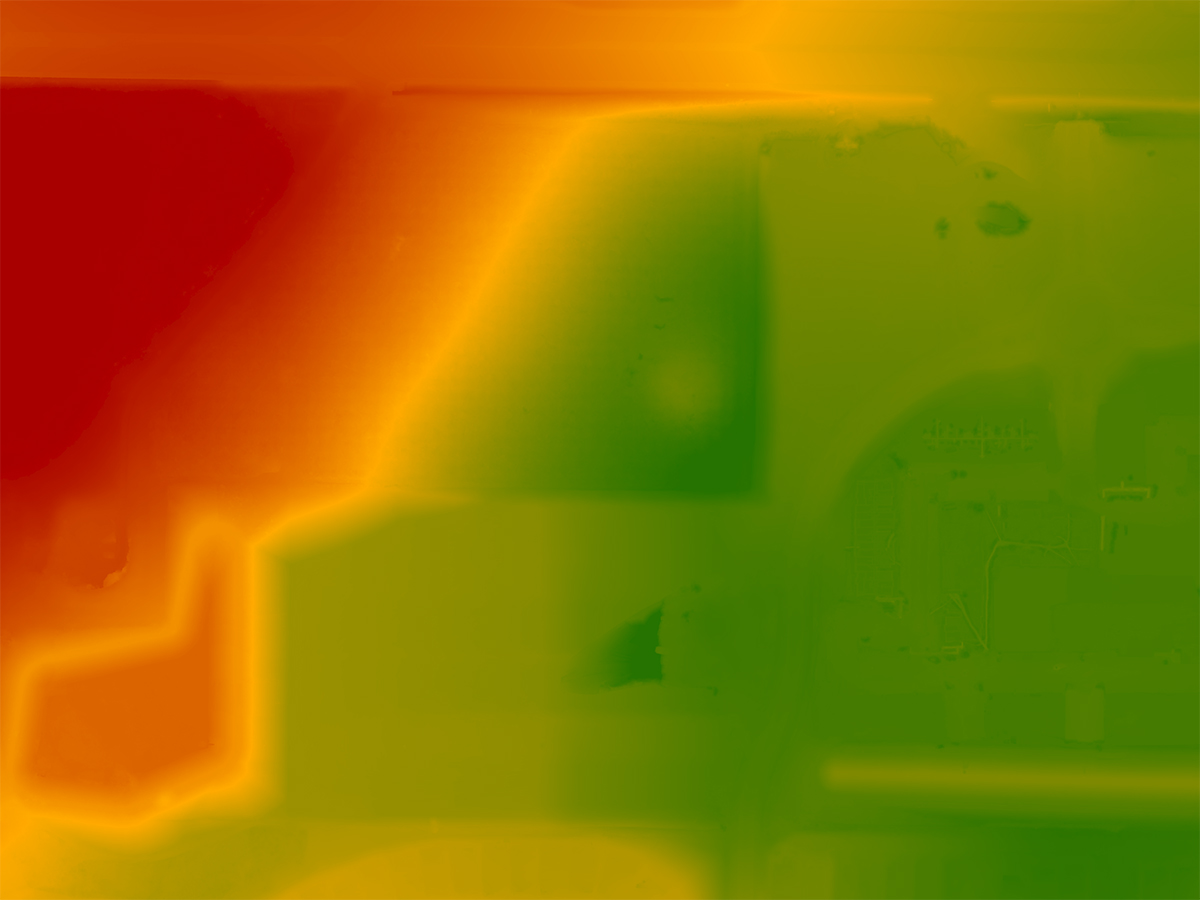
Image 1 – Digital Elevation Model (DEM) raster image datatype where the value of each pixel corresponds to an elevation representing the bare earth
Image 2 – Digital Surface Model (DSM) shows elevation of objects above ground elevation including built and natural features
Image 3 – Digital Terrain Model (DTM) displays the elevation of the ground surface in a vector model adding in break lines and linear features
To learn more about our Unmanned Aerial Surveying services, visit services.kpmfranklin.com/uas
Image 1 – Digital Elevation Model (DEM) raster image datatype where the value of each pixel corresponds to an elevation representing the bare earth
Image 2 – Digital Surface Model (DSM) shows elevation of objects above ground elevation including built and natural features
Image 3 – Digital Terrain Model (DTM) displays the elevation of the ground surface in a vector model adding in break lines and linear features